More people ask us this than any other question, and almost nobody asks it out loud. They search it quietly the week they start planning, slightly embarrassed, because Bali is one of those places everyone has heard of and very few could point to.
So, where is Bali? It sits about eight degrees south of the equator in the Indonesian archipelago, between the islands of Java and Lombok. That is the short version. The longer version explains a lot about how your trip will actually feel, from the flight you book to the time on your phone when you land.
It is not a small question either. As reported by Ngurah Rai International Airport, the island’s sole commercial airport handled 24.1 million passengers in 2025, 15.1 million of whom were on international routes. Bali has direct connections to 36 foreign cities. Getting here is easy. Understanding where you have landed takes slightly more.
This guide covers the Bali location in plain terms, what surrounds it, why the island feels closer to Asia than to Australia despite being neighbours with both, the time zone that catches people out, and how long the flight actually takes from wherever you are.
Where Is Bali Located? The Short Answer
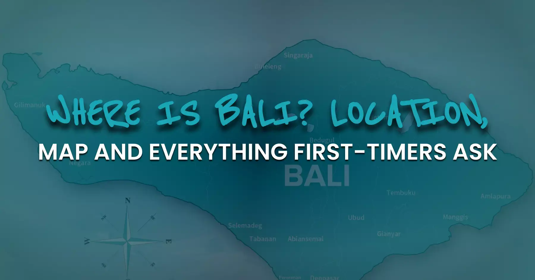
Bali is a province of Indonesia in Maritime Southeast Asia. It lies at roughly 8°20′ South, 115°05′ East, in the chain known as the Lesser Sunda Islands, and it is separated from Java by the narrow Bali Strait to the west and from Lombok by the deeper Lombok Strait to the east.
The Indian Ocean is to the south, which is why the southern beaches get surfed. The Bali Sea is to the north, which is why the northern coast is calm and good for diving. That single fact explains more about where to stay than most guides manage in a thousand words.
Is Bali a Country? What Country Is Bali In?
No, Bali is not a country. It is one of Indonesia’s provinces, formally established on 14 August 1958, with Denpasar as its capital and largest city. So is Bali part of Indonesia? Yes, entirely. You clear Indonesian immigration, spend Indonesian rupiah, and the official language is Bahasa Indonesia, though Balinese is widely spoken at home and English throughout the tourism areas.
Travellers usually type where is Bali Indonesia into a search bar, and the phrasing hints at the confusion: the two are not alternatives to choose between. What makes it understandable is culture rather than geography. Indonesia is the world’s largest Muslim-majority country, while Bali is predominantly Hindu, with its own calendar, temple system and festivals. The island feels distinct from Java or Sumatra in a way that reads, to a first-time visitor, like a separate country. It is not. It is one province among 38.
Bali Map: What Is Around the Island
Knowing where is Bali on the map matters mostly because of what you can add to a trip. The island sits in the middle of a very well connected stretch of Indonesia.
| Neighbour | Direction | Getting there |
| Java (Banyuwangi, Mount Ijen) | West, across the Bali Strait | Ferry from Gilimanuk, around 45 minutes |
| Nusa Penida and Nusa Lembongan | Southeast | Fast boat from Sanur, 30 to 45 minutes |
| Lombok and the Gili Islands | East, across the Lombok Strait | Fast boat from Padangbai, or a 30-minute flight |
| Komodo National Park, Flores | Far east | Flight to Labuan Bajo, around 70 minutes |
| Singapore, Kuala Lumpur, Perth | Regional hubs | Direct flights, under four hours |
Note that the Nusa Islands are administratively part of Bali but geographically separate, reached by boat. People often book a Nusa Penida day trip without realising it involves an early crossing and an open ocean channel.
The Wallace Line: Why Bali Is the Edge of Asia
Here is the detail almost no competing page mentions, and it is the most interesting thing about the Bali Indonesia location. In 1859 the naturalist Alfred Russel Wallace noticed that the animal life changed abruptly between Bali and Lombok, two islands only about 35 kilometres apart. As described by Britannica, the boundary he identified runs from the Indian Ocean through the Lombok Strait and northward through the Makassar Strait, marking the division between Asian and Australian faunal regions.
The reason is depth. The Lombok Strait is deep enough that it stayed underwater even during ice ages, when lower sea levels joined Bali, Java and Sumatra to mainland Asia. Bali sits on the Asian side of that line. Lombok, Komodo and Flores do not.
This is not trivia. It is why Bali’s landscape, birdlife and forests feel continuous with Southeast Asia, and why crossing to Komodo National Park feels like arriving somewhere genuinely different rather than somewhere merely further along.
How Big Is Bali, and Why Journey Times Surprise People
Bali covers about 5,590 square kilometres with a population of roughly 4.46 million, according to Indonesian statistics. It is smaller than Cyprus. Mount Agung, the highest point and the island’s most sacred mountain, reaches 3,031 metres.
Small island, short drives. Except it does not work that way. There is no motorway network across the interior, one main road rings much of the coast, and traffic through the southern towns is constant. Seminyak to Ubud is 36 kilometres and can take two hours at five in the afternoon.
| From the airport (DPS) | Typical drive |
| Kuta, Jimbaran, Nusa Dua | 20 to 45 minutes |
| Seminyak, Canggu | 45 to 90 minutes |
| Ubud | 90 minutes to 2 hours |
| Amed, Lovina, Munduk | 3 hours or more |
This is the single most useful thing to understand about the geography. Choose two or three bases and stay put. Our guide to getting around Bali covers the routes in detail.
Bali Time Zone: The One That Catches People Out
Bali runs on WITA, Indonesia Central Time, which is UTC+8. There is no daylight saving, so the offset never changes. The trap is domestic. Jakarta and most of Java run on WIB, UTC+7, an hour behind. Travellers connecting through Jakarta regularly misread a boarding time by an hour, and people booking onward flights to Java calculate the wrong arrival. Check which zone every timing refers to.
Usefully, Bali shares its clock with Singapore, Hong Kong, Kuala Lumpur, Perth and Manila. It sits two hours behind Sydney for most of the year, three when Australia is on daylight saving time, seven to eight hours ahead of the UK, and twelve to fifteen ahead of North America.
Flight Time to Bali
Every international flight lands at Ngurah Rai International Airport, code DPS, in Tuban just south of Kuta. There is no second airport and no domestic-only alternative, so every visitor arrives the same way.
| Departure | Typical flight time | Direct? |
| Perth | 3 hours 30 | Yes |
| Singapore | 2 hours 40 | Yes |
| Kuala Lumpur | 3 hours | Yes |
| Sydney, Melbourne | 6 to 7 hours | Yes |
| Hong Kong | 5 hours | Yes |
| Dubai, Doha | 9 to 10 hours | Yes |
| London | 16 to 19 hours | One stop |
| Los Angeles, New York | 19 to 24 hours | One or two stops |
Australians treat where is Bali as a settled question and the flight as weekend-length, which is why Melbourne and Sydney rank among the airport’s busiest international routes. From Europe or North America, connections run through Singapore, Kuala Lumpur, Doha, Dubai or Hong Kong.
Arrival Requirements: Visa, Levy and Arrival Card
Three separate things, and travellers routinely confuse them.
- Visa. Many nationalities buy a Visa on Arrival at IDR 500,000 for 30 days, extendable once. Applying for the e-VOA online before you fly lets you use the automated gates. Longer or non-tourist stays need a visa arranged in advance
- Bali tourist levy. IDR 150,000 per person per visit, paid through the official Love Bali portal. Separate from your visa, and payable by children too
- All Indonesia arrival cards. A free digital declaration covering immigration, customs and health, completed shortly before travel. Not a payment
Do all three online and immigration takes minutes. Do them in the arrival hall in August and it takes an hour. Our Bali visa and entry pages set out current requirements by nationality.
What First-Timers Get Wrong About Bali’s Geography
- Assuming Bali is a country rather than one Indonesian province
- Thinking the island is close to Thailand. It is roughly 2,900 kilometres away
- Booking Ubud for beach days. Ubud is inland, around an hour from the coast
- Treating the Gili Islands as part of Bali. They belong to Lombok
- Reading mapping apps literally and planning four locations in one day
- Landing at a second airport that does not exist. Everything arrives at DPS
- Missing that Nusa Penida needs a boat crossing, not a drive
- Booking a Jakarta connection without checking the time zone difference
- Expecting the whole island to have the same weather. The north and the mountains differ from the south
- Choosing the south coast for calm swimming. That side faces the Indian Ocean
Planning Around the Geography
Once you know where is Bali in relation to everything else, the trip plans itself more easily. South for beaches, surfing and restaurants. Centre for rice terraces, temples and Ubud. East and north for quiet villages, diving and volcano views. Islands offshore when you want a change of pace. What we do is build itineraries around real driving times rather than optimistic map estimates, with drivers who live here and know which route works at four in the afternoon.
Where Is Bali on Your Own Map?
Where is Bali? Eight degrees south of the equator, on the Asian edge of a line drawn through the sea in 1859, a province of Indonesia with its own Hindu calendar, one airport, one time zone, and journey times that consistently outlast expectations.
Tell us how long you have and what you want from the trip, and we will build the days around the geography rather than against it. Message us on WhatsApp or through our contact page.
Frequently Asked Questions
- Where is Bali located in the world?
In Southeast Asia, about eight degrees south of the equator, in the Indonesian archipelago between Java and Lombok. Coordinates are roughly 8°20′S, 115°05′E. - What continent is Bali in?
Asia. Bali sits on the Asian side of the Wallace Line, which runs through the Lombok Strait just to its east. - Is Bali a country?
No. It is one of Indonesia’s 38 provinces, with Denpasar as its capital. - What country is Bali in?
Indonesia. You clear Indonesian immigration and spend Indonesian rupiah. - How far is Bali from Australia?
Around 2,800 kilometres from Darwin and 4,600 from Sydney. Perth is the closest major Australian city by flight time, at about three and a half hours. - Is Bali near Thailand?
Not really. Bangkok to Denpasar is roughly 2,900 kilometres and around four and a half hours of flying. - What is the Bali time zone?
WITA, or UTC+8, with no daylight saving. That is one hour ahead of Jakarta. - How long is the flight to Bali?
Under three hours from Singapore, six to seven from Sydney, nine to ten from the Gulf, and sixteen to nineteen from London with one stop. - Which airport do I fly into?
Ngurah Rai International Airport, code DPS, near Kuta. It is the only commercial airport on the island. - Are the Gili Islands and Nusa Penida part of Bali?
Nusa Penida is administratively part of Bali. The Gili Islands belong to Lombok, a separate province, though both are reachable by fast boat.